I’m happy to be adding 26 new printable maps to PrintableWorldMap.net for people of any age who want to learn about or brush up on their geography.
A lot of the new batch are topical maps of the United States and its geographical history. There are maps of acquired territories during the 1700 and 1800s, maps of Union and Confederate states during the Civil War, electoral votes per state, major cities, and capitals.
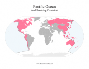
The new water maps show the world’s oceans, seas, gulfs, and lakes. The body of water in question is colored blue, with bordering countries either labeled or colored pink. Major entries include the Atlantic and Pacific Oceans, the Persian Gulf, the Gulf of Mexico, the Mediterranean Sea, and the Great Lakes
There are 200+ different maps to choose from at PrintableWorldMap.net, including both blank and labeled templates. Each map is free to download and print as a PDF.