The new printable maps at PrintableWorldMap.net range from country maps to continent maps. With the addition of these new maps, there are now 575 maps at the site, each free to download and print.
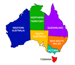
The new additions include several maps of Australia, with versions indicating major cities, bodies of water, and states and territories.
PrintableWorldMap.net also has U.S. state and county maps, region maps, and even constellation maps of the stars and astrological signs. There are blank maps and labeled maps and some maps are available in both landscape and portrait organizations.
The topical maps, many of which are in full color, cover: time zones, bodies of water, the Roman empire, state flags, the Oregon Trail, and animal habitats.
The maps at PrintableWorldMap.net download as PDF files. Downloaded them one at a time for free, or get the entire map collection in one convenient file for $9.