After a long time between updates, I am very excited to add a lot of fun new printable maps to PrintableWorldMap.net. Whether you’re a history teacher, a student learning about animal habitats or someone who really needs to find out the time zone in Newfoundland, there’s something here for you.
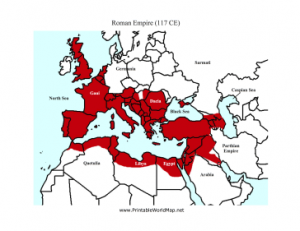
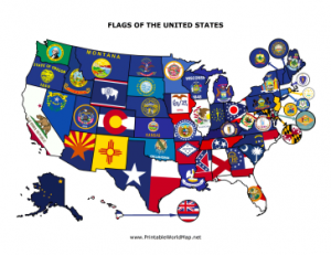
I’ve introduced a new category devoted to topical maps in order to include places of historical importance. These include shaded maps with helpful dates concerning the Roman Empire, the Genghis Khan territories and the Great Wall of China. There are also maps specific to the U.S. such as the 13 Original Colonies, the Trail of Tears, state flags, time zones and dates of statehood. Finally, just because they’re cute, I’ve got habitat maps, which feature colored zones of Australia indicating where koalas, wombats, platypus and kangaroos live.
There are 165 different maps to choose from at PrintableWorldMap.net. There are a number of labeled maps for learning states, capitals and countries, but there are blank maps as well. Each map is free to download and print as a PDF.
Free Printable Maps
Previous post: Printable Dot to Dot Puzzles
Next post: Fourth of July Printables Roundup